Convert GPX to GeoJSON in C#
GPX is an XML schema designed as a common GPS data format. Whereas, the GeoJSON format is an open standard design to represent geographical features. In certain cases, you may… Read More »Convert GPX to GeoJSON in C#
GPX is an XML schema designed as a common GPS data format. Whereas, the GeoJSON format is an open standard design to represent geographical features. In certain cases, you may… Read More »Convert GPX to GeoJSON in C#
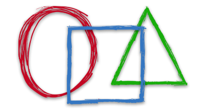
In certain cases, you may need to create different objects by drawing the shapes such as circles, lines, rectangles, etc. Also, you may have to draw these shapes on images… Read More »Draw Shapes in Java: Lines, Arcs, Ellipses, and Rectangles
OBJ files are standard 3D image formats that are compatible with various 3D image editing software programs. In a 3D object file, we can find 3D coordinates, texture maps, polygonal… Read More »Convert OBJ to USDZ in Python
HTML files are used to display data or information in web pages. Sometimes, you may need to create an HTML file within your projects. Following such scenarios, this article covers… Read More »Create HTML File in C#
XER and MPP files are widely used in project management and project planning applications. You might need to convert an XER file to MPP format in your Java applications. Considering… Read More »Convert XER to MPP in Java
In computer graphics and image processing, image skew is an angle deviation of rectangular images. It is also known as image tilt or distortion. The term “skew” refers to the… Read More »Image Skew Correction in Java
A PDF booklet is used to transform a document into a saddle-stitch (or another) format, which could be used for printing. In a PDF booklet, each two pages are printed… Read More »Create Booklet from PDF in C#
DWG files are CAD drawings containing vector image data and metadata written with binary coding. In some use cases, you may want to search text in a DWG file. Following… Read More »Search Text in DWG Drawing using Java
HTML is a markup language that is used to create and design web pages. They can include text in different forms like paragraphs, lists, tables, etc. Likewise, it can contain… Read More »Change Text Color in HTML using C#
Latitude and longitude values are used to specify any location on the earth. Whereas, the Degrees Minutes Seconds is another format for geographical coordinates. In some scenarios, you may need… Read More »Convert Decimal Degrees to Degrees Minutes Seconds DMS in C#